| Status: | Active, open to new members |
| When: | Afternoons 2:00 pm Twice a month, on the 2nd Thursday & 4th Thursday of the month |
| Venue: | Various |
Walking 3: Explore the Countryside!
Launched in April 2025, Honiton u3a's latest walking group is perfect for those who enjoy shorter, more leisurely rambles.
We meet twice a month at 2 PM – specifically on the 2nd Thursday and 4th Thursday. Our walks cover 2-3 miles and last 1-2 hours, maintaining a relaxed pace. Whenever possible, we embrace the natural beauty of the area by sticking to off-road paths. All our routes conveniently start on foot from Honiton.
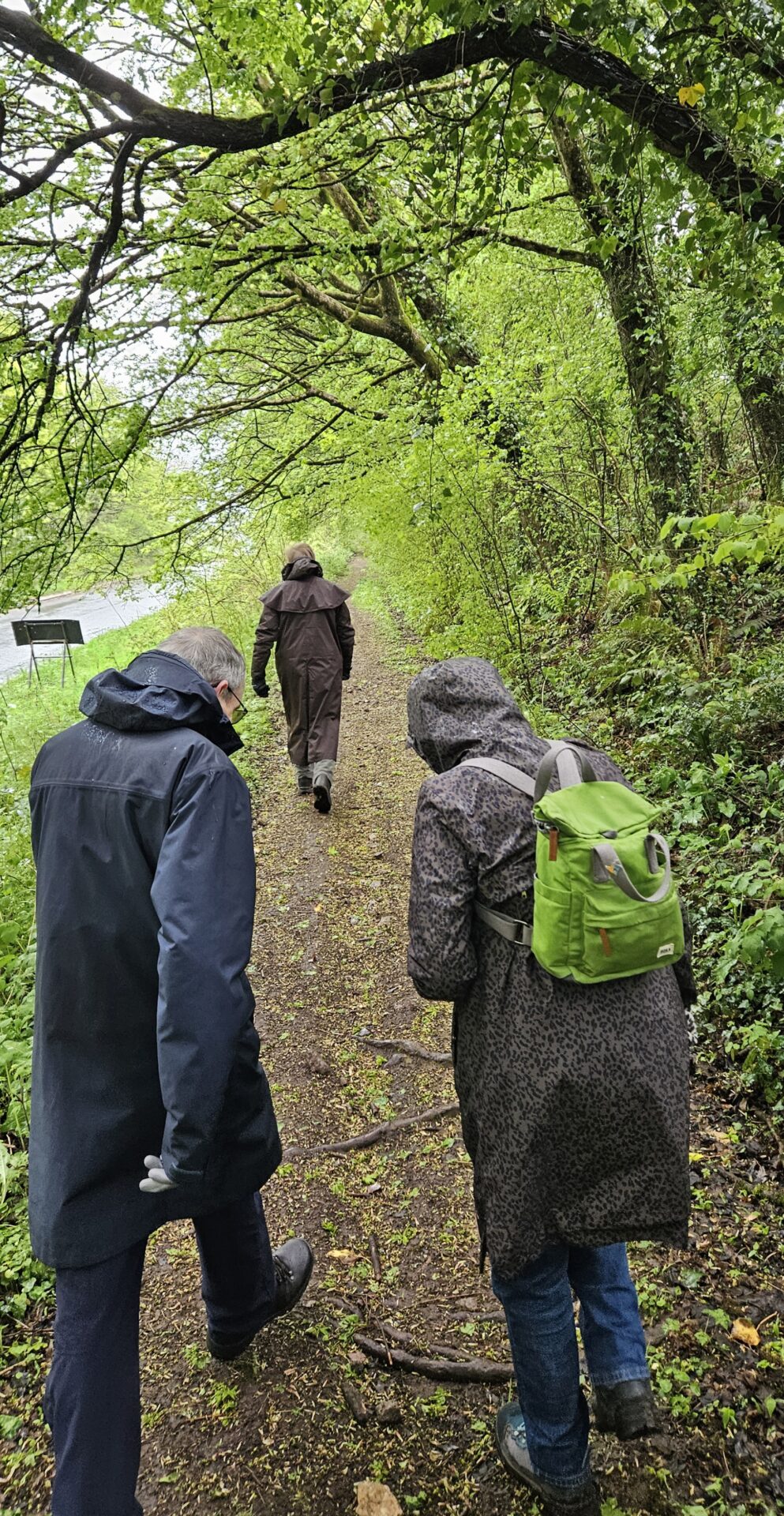
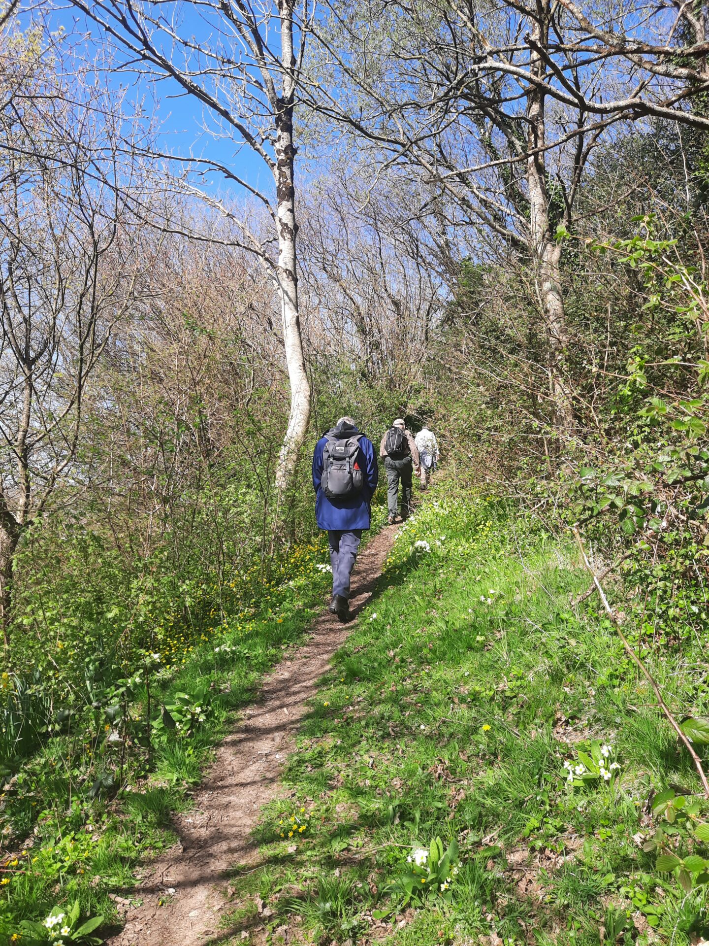
Get ready for: These are true cross-country walks, off-road whenever possible, on varied surfaces like paths, bridleways, and tracks. You might even find yourself navigating a classic Devon bank! Expect the ground to be uneven, potentially rough or rutted, and be prepared for various types of stiles and short steep sections. Depending on the time of year and recent rainfall, we may encounter muddy fields or livestock. We encourage all members to voice any specific concerns they might have about elements like stiles, cattle, or ascents, and we'll do our best to address them. Walk details are always emailed a minimum of one week prior. Dogs are not allowed.
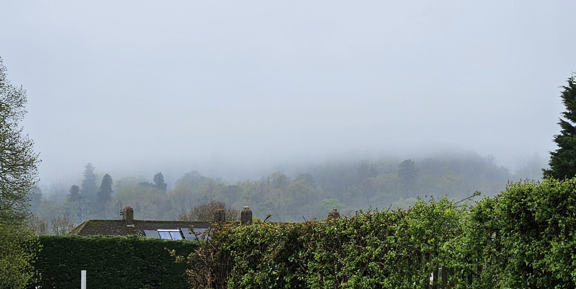
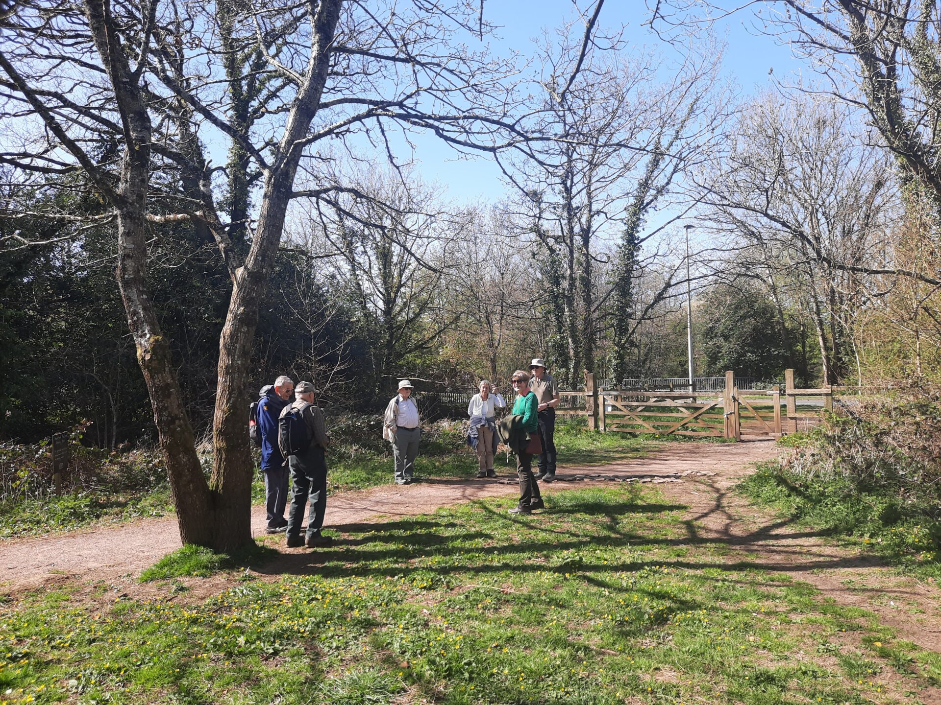
On our first walk we enjoyed a cool but sunny afternoon. On our second walk heavy rain was forecast all day but happily we had barely 20 minutes of rain. On our third walk we enjoyed a warm and dry afternoon.
Honiton u3a members can see more details and photos on the Honiton u3a (private) facebook group https://www.facebook.com/groups/1928878700775448/?ref=share
Brian H.
To contact the Group Leader click on this link: Contact a Group Leader
Walking Group 3 (Short Walks) - Our Routes
Route 1: The Glen, St Michael's Church, Honiton Bottom Nature Reserve
Walk details: Approx 2.7 miles, 100 metres (330ft) ascent/descent. Difficulty rating: Moderate
No stiles, a few dozen uphill steps, a couple relatively short uneven stretches. Mainly tarmac, except when crossing fields. One Devon bank ascent (optional, please ask!).
Start point: On Pine Park Road near the railway bridge.
Parking: Any Honiton public car park. The nearest is on New Street or free on-street parking on Pine Grove, Honiton.


Route 2: Library, Beggar's Lane, Turk's Head Lane
Walk details: Approx 2.5 miles, Quite flat.Difficulty rating:Easy
Urban footpaths, parks and lanes. Mostly tarmac but includes an unsurfaced track, path and grass. No stiles, no hills.
Start Point: Outside Honiton Library, New Street.
Parking: Car park across the road from Honiton Library.
Route 3: St Michael's Church, Stoney Lane
Walk details: Approx 2.9 miles, 110m ascent/descent. Difficulty rating: Moderate.
Across several fields and along quiet lanes and tracks.
Enjoy distant views over Honiton town and north of Honiton.
No stiles. One rough and always wet track which can often be a stream depending upon recent rainfall. One always wet and usually soft and squelchy section. Mostly on a quiet lane.
Start point: St Michael's Church gateway
Parking: On street parking (free) is available on Church Hill or on local residential roadways. The nearest public car park is on New Street, opposite the Library.


Route 4: St Paul's Church, Tracey, Combe Wood
Walk details: Approx 2.9 miles, 85m ascent/descent. Difficulty rating: Moderate.
Urban walking and across several fields and on quiet lanes and tracks.
Enjoy distant views south of Honiton and walk near the River Otter.
Several stiles and occasionally a short clamber up/down depending upon which track is taken through Combe Wood.
Start point: St Paul's Church, Honiton High Street
Parking: Any town carpark or on street parking (free)
Route 5: Hale Lane, Tunnel Lane
Walk details: Approx 2.9 miles, 134m ascent/descent. Difficulty rating: Moderate.
Route: Hale Lane, Hale Farm, Perrie Hale, Northcote Hill, Tunnel Lane, returning via Hale Farm.
Across several fields and along quiet lanes and tracks.
Enjoy distant views north and south of Honiton.
Several stiles. One short very uneven laneway.
Start point: At the Kings Road (A35) / Hale Lane junction.
Parking: On street parking (free) is available on Hale Lane, near the Start Point.

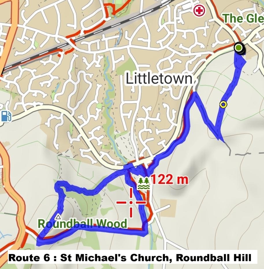
Route 6 : St Michael's Church, Roundball Hill
Walk details: Approx 2.9 miles, 155m ascent/descent. Difficulty rating:Moderate
Route: St Michael's Church, Honiton Bottom, Roundball Hill via Roundball Wood, Roundball Lane.
Across fields and along quiet roads. Enjoy distant views over Honiton town and north of Honiton and towards Dartmoor.
No stiles. One Devon bank ascent (optional, please ask!). Roundball Wood has a couple of wet and usually soft muddy sections. The final ascent to the hilltop is particularly steep but quite short.
Start point: St Michael's Church gateway, at the top of Church Hill.
Parking: On street parking (free) is available on Church Hill or on local residential roadways. The nearest public car park is on New Street.
Route 7: Route 7) [Tarmac Route] Library, Streamers Meadow, The Glen
Walk details: Approx. 3 miles. Some urban ascent/descent. Difficulty rating: Easy
Paved surfaces throughout. Following The Gissage as far as possible on the route out.
Walk down Jerrard Close and turn left onto Streamers Meadow. Turn right down the little path that leads to the bowling club and walk through Streamer's Meadow, crossing the Gissage and exiting onto Millers Way.
Turn left and walk up the steep hill. At the top through the footpath by the railway line exiting onto Rosemount/ Littletown by the railway bridge.
Turn left across the bridge and down the road a short way, crossing over the road to pick up the footpath that runs alongside the Gissage all the way to Battishorne Way.
Cross Battishorne Way and go up Brand Lane as far as the bridge over the Gissage at Roundball Lane.
To return: Back down Brand Lane and along Higher Brand Lane exiting onto Weatherill Road. Along there past St Michael’s Church then right at Lower Marlpits Hill and left down Parsonage Lane, under the road bridge (occasionally flooded) and all the way through the Glen, then down the footpath by the railway line exiting right at the bottom onto New Street and back down to the library.
No stiles, no livestock, no muddy fields.
Start Point: Outside Honiton Library, New Street.
Parking: Carpark across the road from Honiton Library.
Route 7 Map - There’s no map for this route

Route 8: Library, St Michael's, Littletown Green
Walk details: Approx. 2.9 miles, 80m ascent/descent. Difficulty rating: Easy
Across several fields and along quiet lanes and tracks. Enjoy distant views over Honiton town and north of Honiton.
No stiles.
Start Point: Outside Honiton Library, New Street.
Parking: Carpark across the road from Honiton Library.
Our 1st Walk


Our 2nd Walk (Quite a contrast to our 1st Walk!)